Background and priorities
External resources:
Background
Public Use Microdata Areas (PUMAs) are non-overlapping, statistical geographic areas that partition each state or equivalent entity into geographic areas containing no fewer than 100,000 people each. They cover the entirety of the United States, Puerto Rico, Guam, and the U.S. Virgin Islands. The Census Bureau defines PUMAs for the tabulation and dissemination of decennial census and American Community Survey (ACS) Public Use Microdata Sample (PUMS) data. Additionally, the ACS and Puerto Rico Community Survey use them to disseminate their respective period estimates.
The delineation of new PUMAs occurs after the completion of the decennial census as part of a program involving the State Data Centers (SDCs). Decennial census population counts and updated census tracts are critical inputs into the delineation process.
Criteria
The Census Bureau lists the following criteria for a PUMA:
- 2020 Census tracts are used to build PUMAs
- A PUMA contains at least 100,000 population according to Census 2020 population counts
- A PUMA is expected to contain at least 100,000 population throughout the decade. PUMAs can be combined if population drops below the threshold
- PUMA containing more than 200,000 population should be split unless there is sufficient reason not to
- A county that has tracts in multiple PUMAs must have at least 10,000 population in each PUMA-county intersection
- PUMAs should be contiguous
Priorities
Beside the criteria, the Census Bureau lists also a number of recommended priorities for the delineation process:
- Avoid splitting counties
- Avoid splitting Core-Based Statistical Areas (CBSA - Metropolitan/Micropolitan areas)
- Avoid splitting towns, villages and urban areas
- Avoid splitting American Indian territories
The New York State Data Center took those recommendations into consideration and created its own list of priorities
- Avoid splitting the 10 economic regions/labor market regions (more a criterium than a priority)
- Avoid splitting counties. Splitting counties negatively impacts formation of Place-of-Work and Migration PUMAs. These are special PUMAs that are used to code place-of-work and origin of a recent move. These special PUMAs are constructed from whole counties and whole PUMAs. Splitting counties has a negative impact on the number of these special PUMAs and will limit the flexibility of special tabulation on commuting and domestic migration.
- Use 2010 PUMA boundaries to enable creating timeseries without breaks
- Avoid splitting towns, villages
- Avoid PUMAs that are in different areas of responsibilty of regional planning offices
- It is best when PUMAs contain areas that have similar characteristics. In statistical terms: it is better to minimize variation within a PUMA and maximize variation between PUMAs.
Local stakeholders and others might have additional or different priorities.
Timeline
The Census Bureau asks the State Data Centers to submit their PUMA changes before January 31, 2022. Feedback from stakeholders can be handled until January 7'th to give the NY State Data Center time to finalize the submission.
Stakeholder involvement
The combination of criteria and priorities means that not all priorities can be addressed simultaneously. Choices have to be made.
The NY State Data Center is asking stakeholders for feedback. This can be feedback on the plans presented for each or the regions, feedback on the priorities, or any other questions or comments. It is also possible to attach your own preferred PUMA delineation in the feedback (see below). Please contact the State Data Center through PUMA2020feedback@cornell.edu
Tract Equivalence Files
The Census Bureau developed an application on top of QGIS to help with all kinds of Geographic Partnership programs including PUMA delineation. This application is called GUPS and it can be downloaded from the Census Bureau PUMA 2020 information page.
One of the features is importing and exporting Tract Equivalence Files (TEF). This is a comma separated text file with each line representing on tract. Each line contains identifiers for the tract (State, County and Tract IDs) and also the PUMA ID and PUMA name this tract is assigned to.
The NY State wide Tract Equivalence File that puts the 2020 tracts as well as possible into the 2010 PUMA boundaries was used as a starting point for our process and can be downloaded here
How to use the regional information on this web page
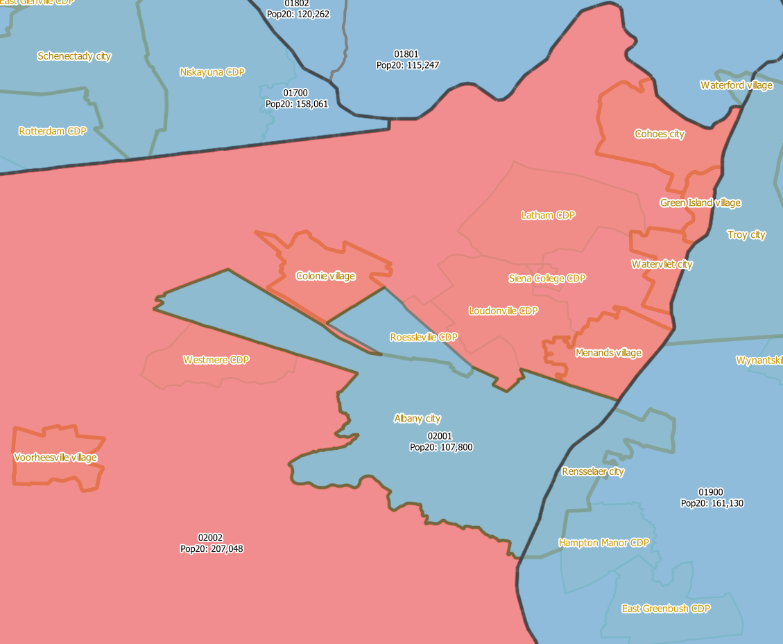
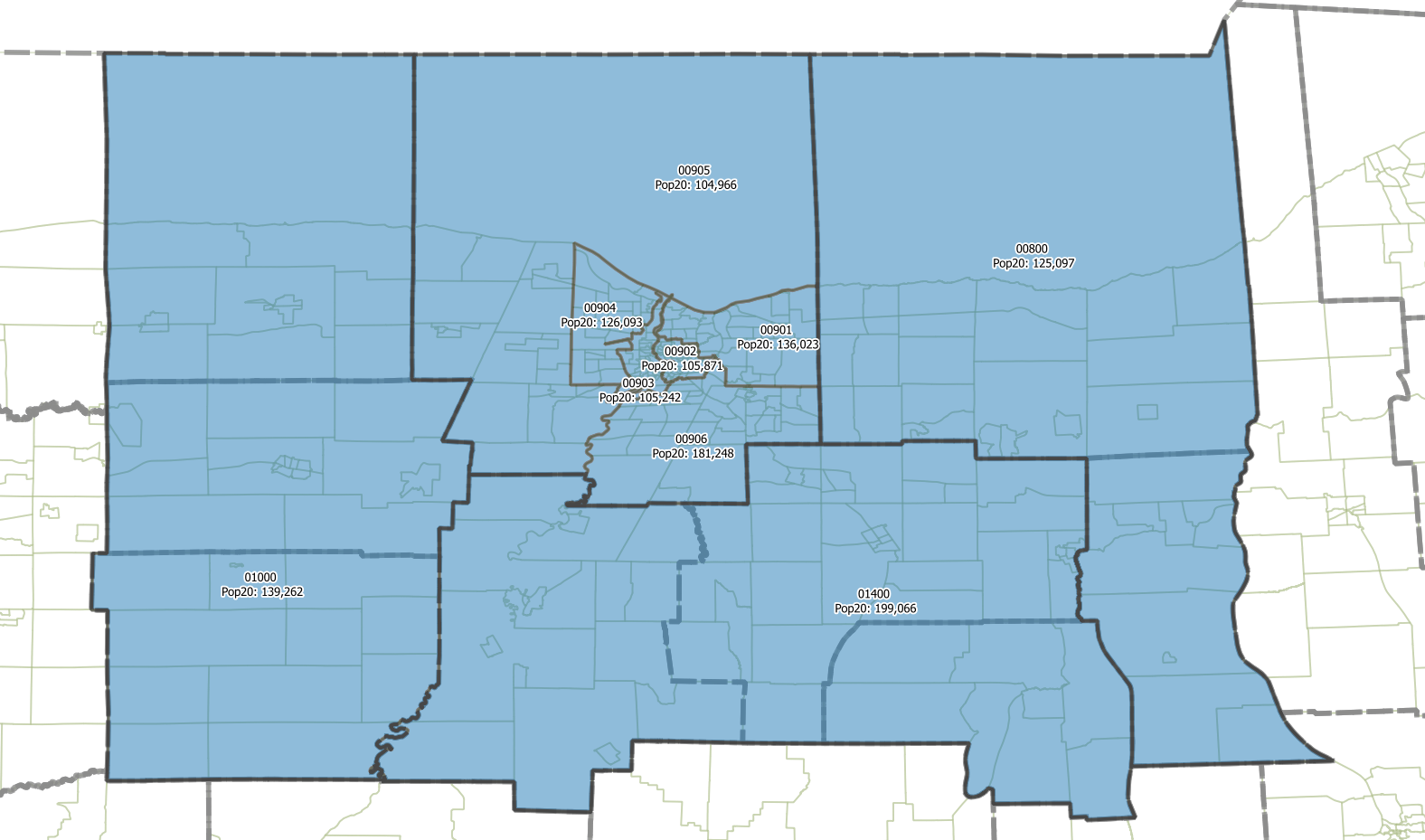
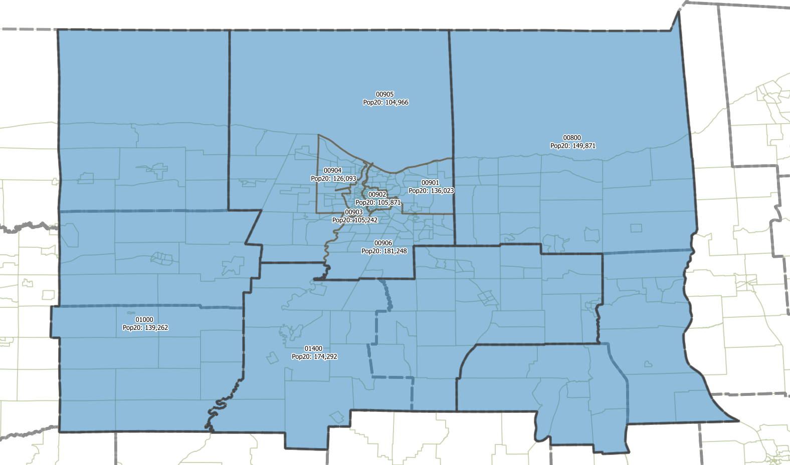
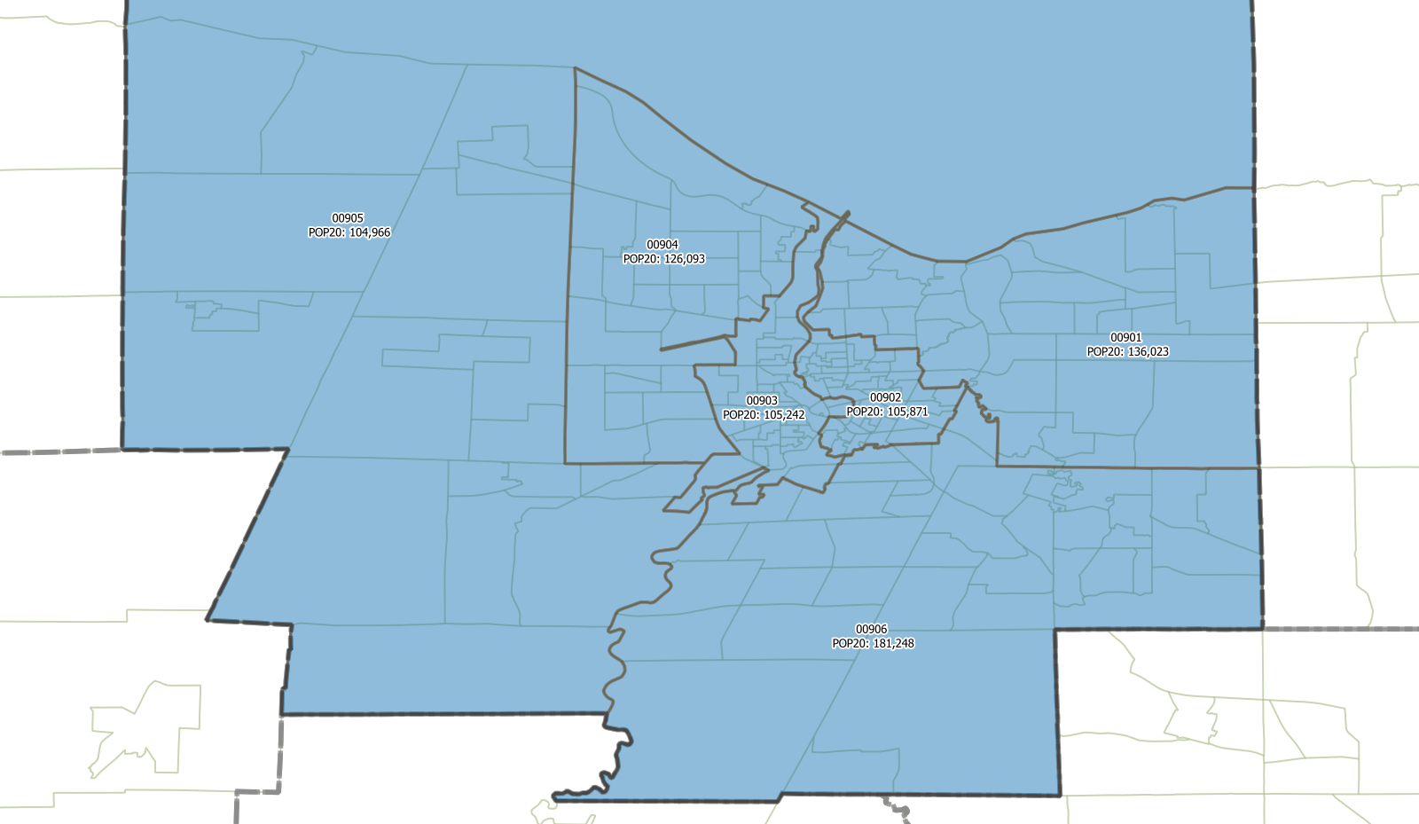
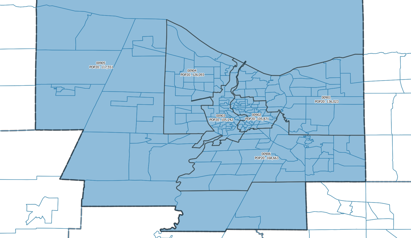
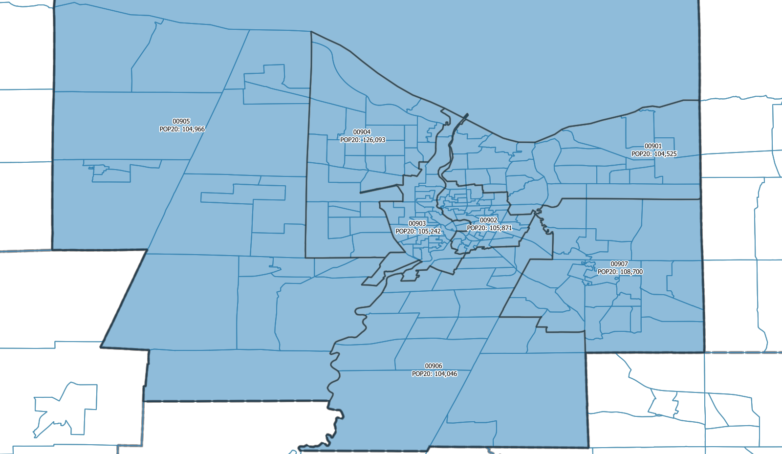
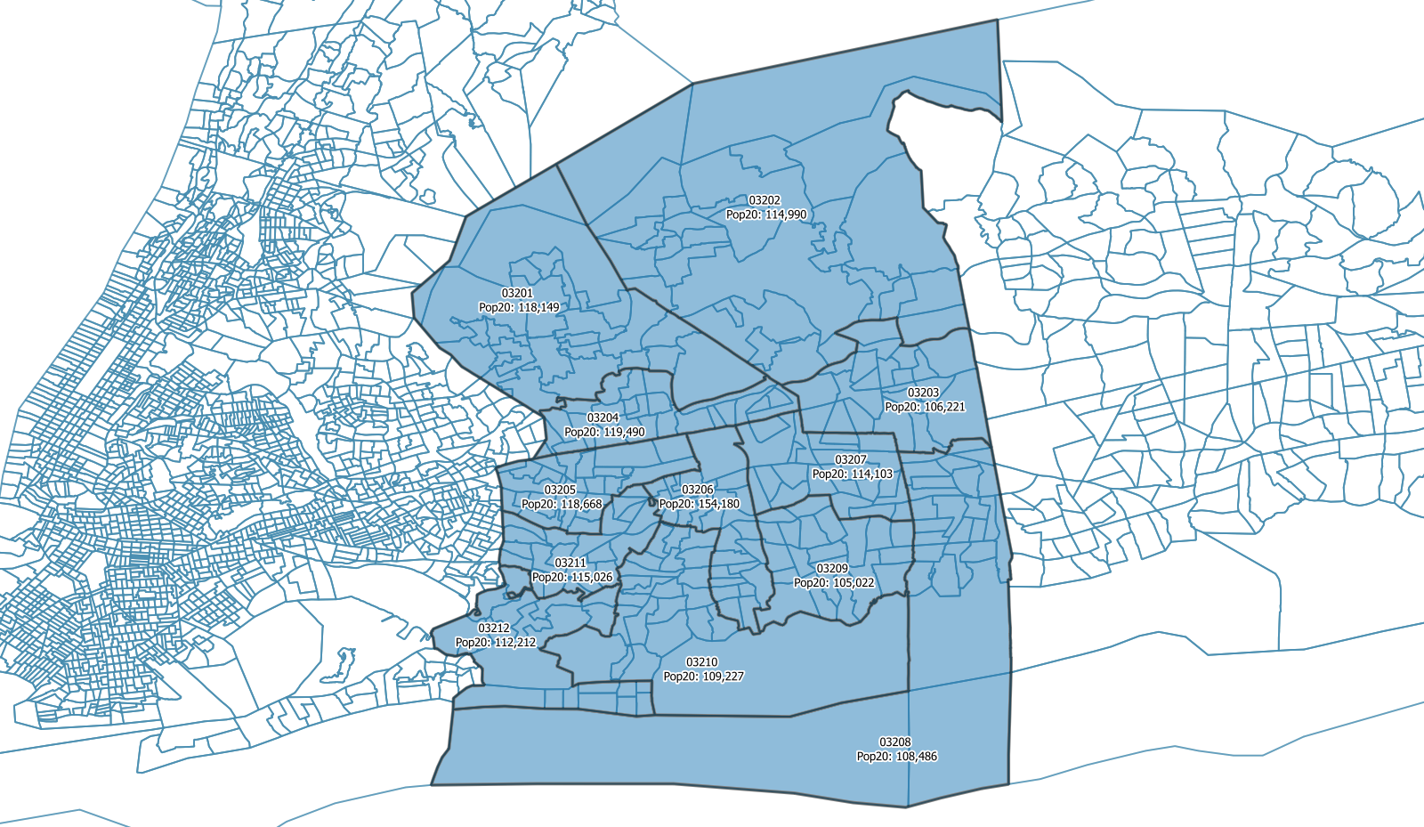
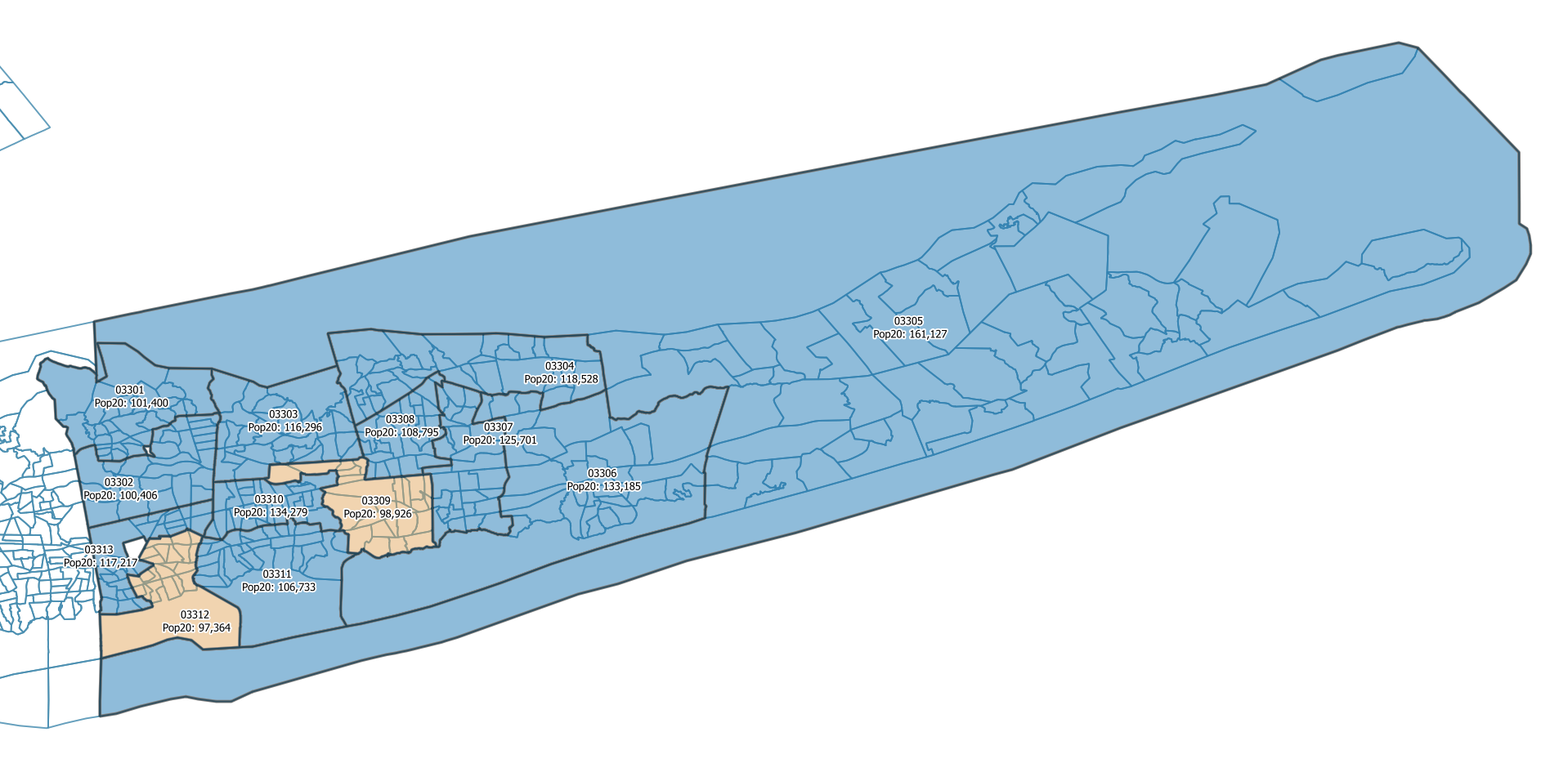
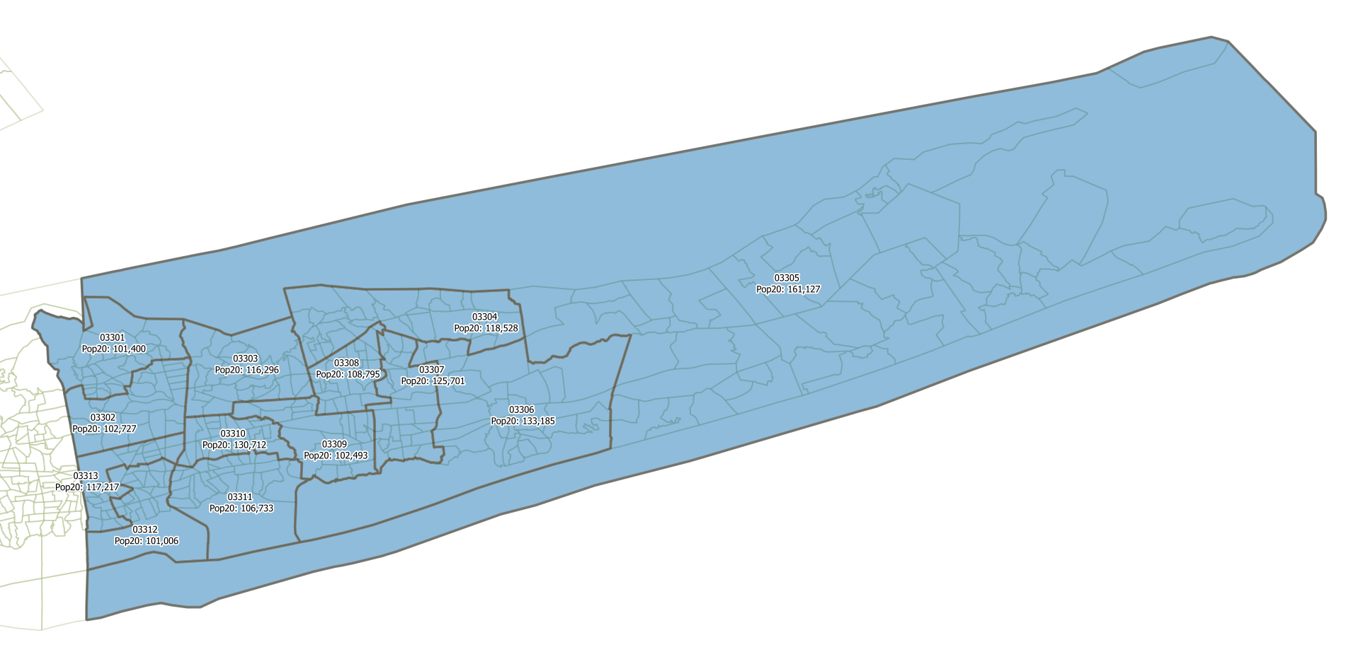
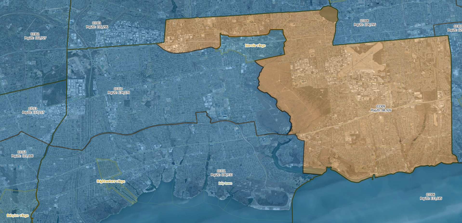
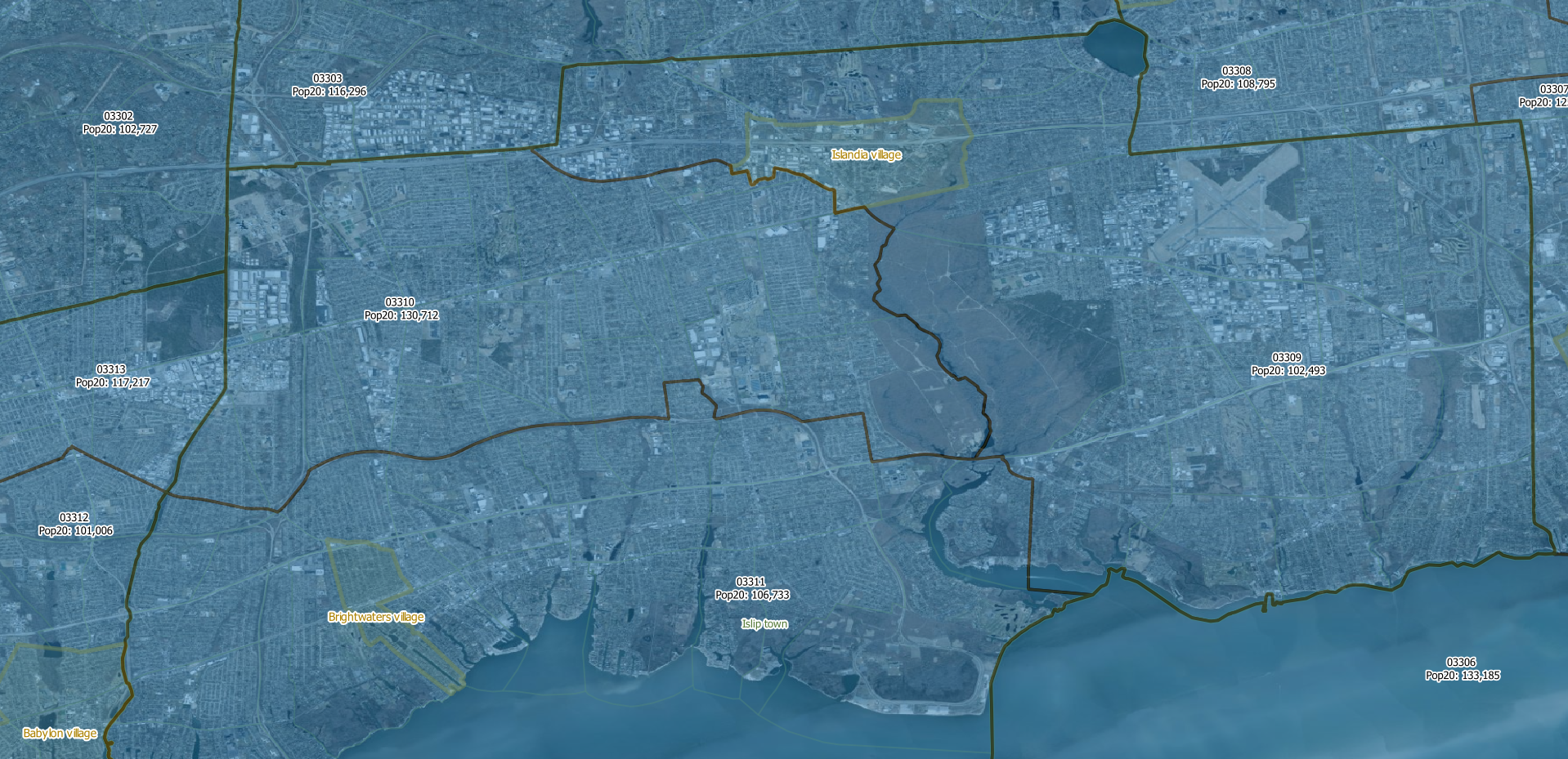
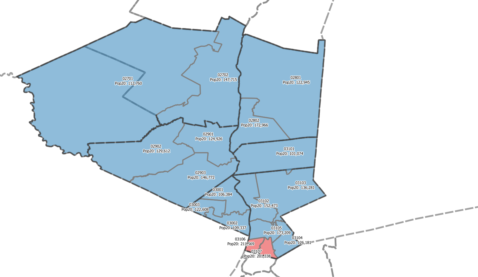
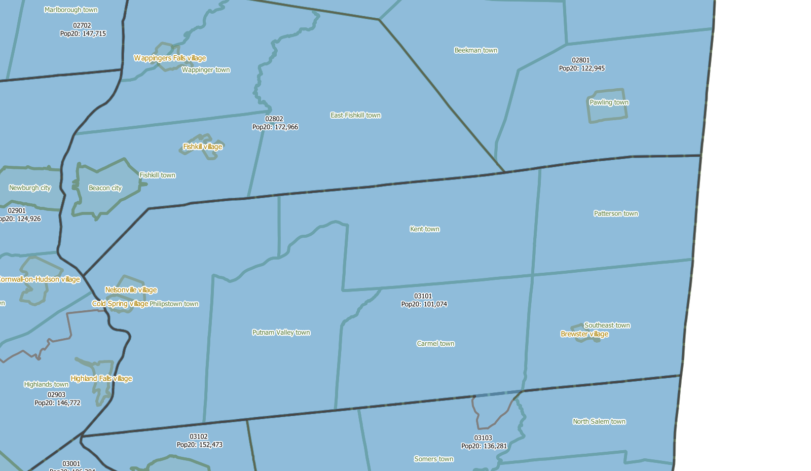
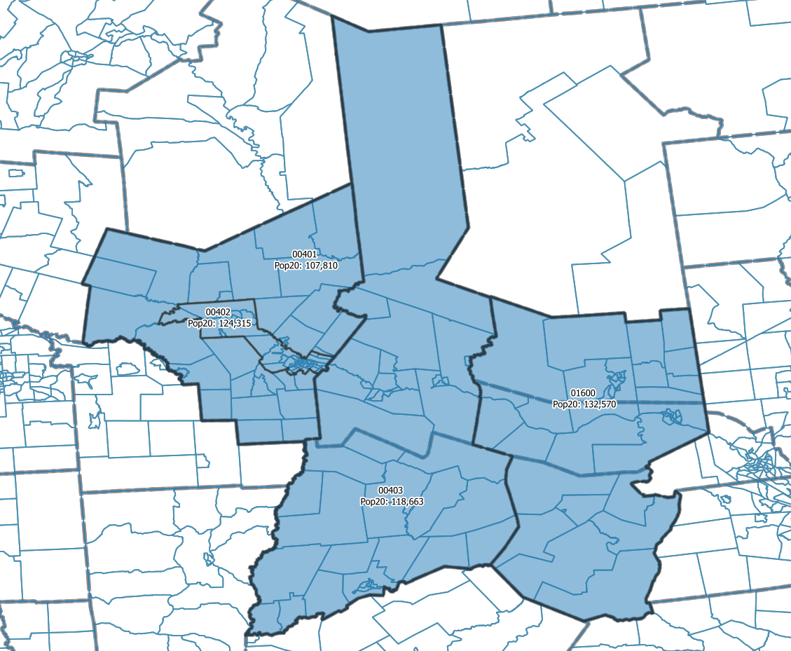
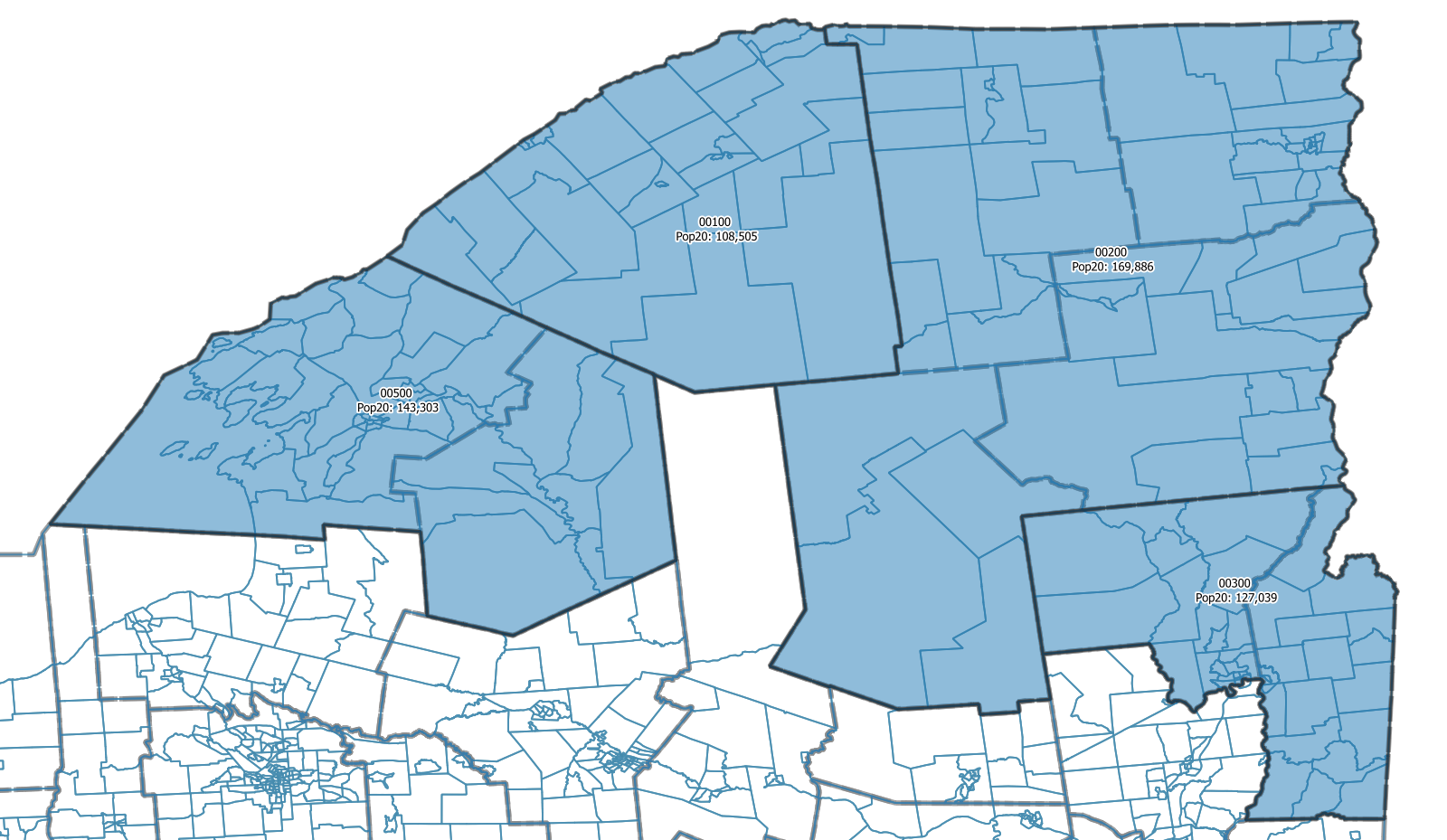
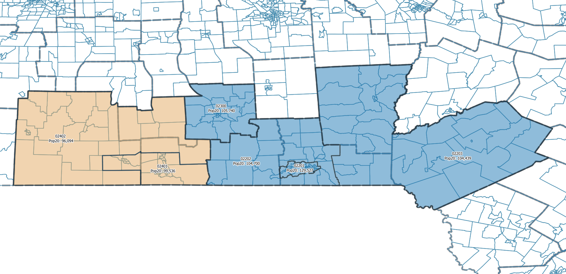
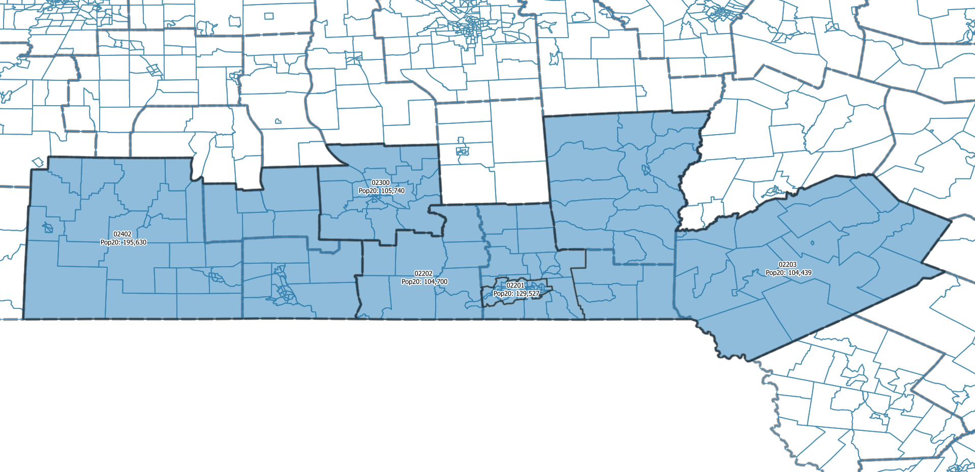
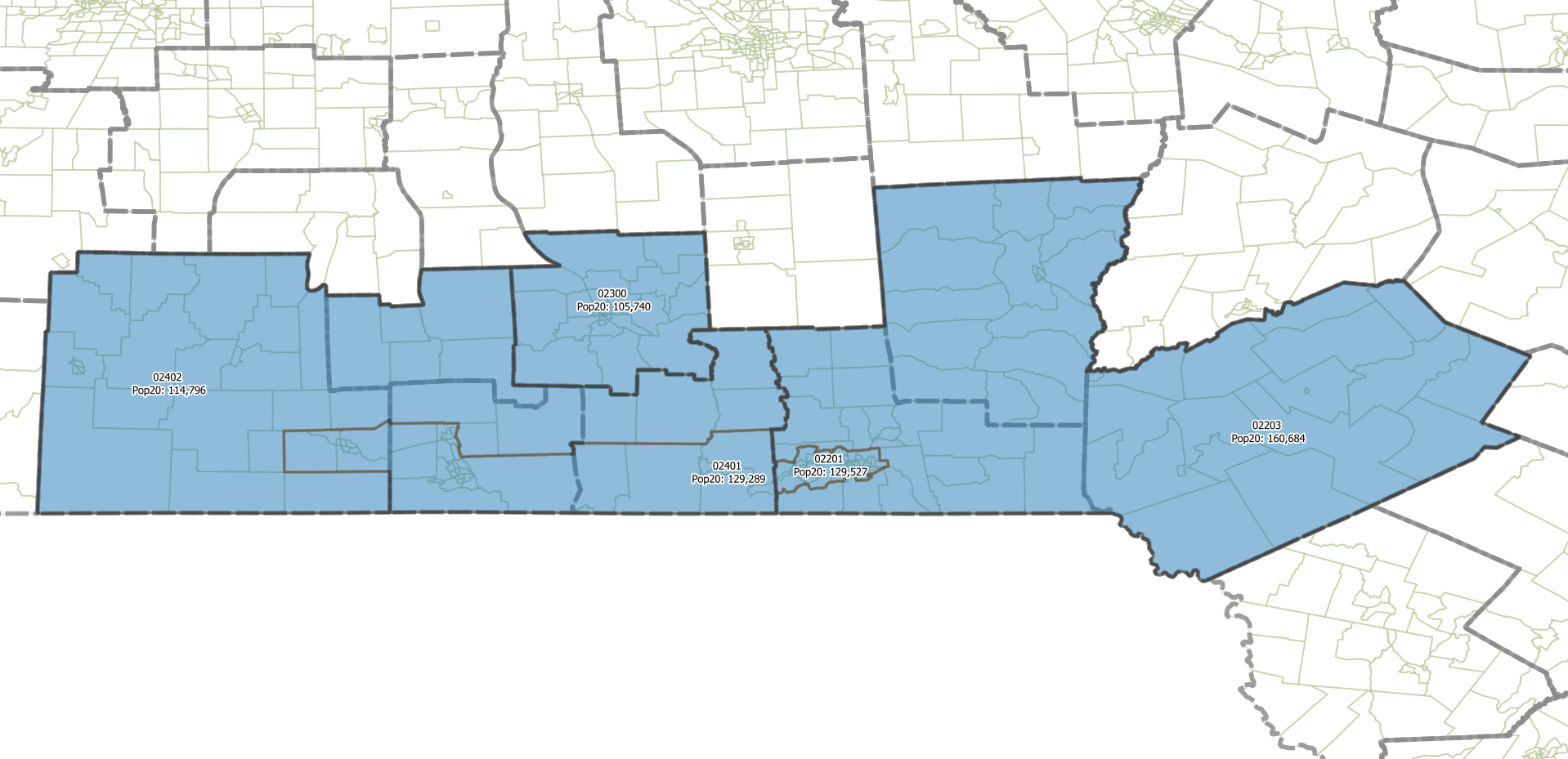
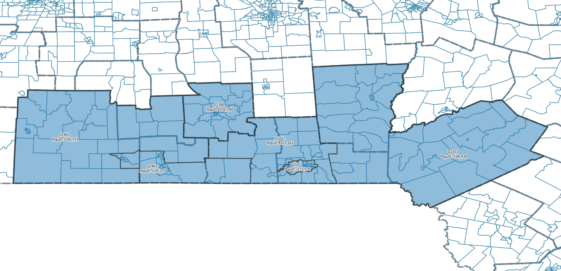
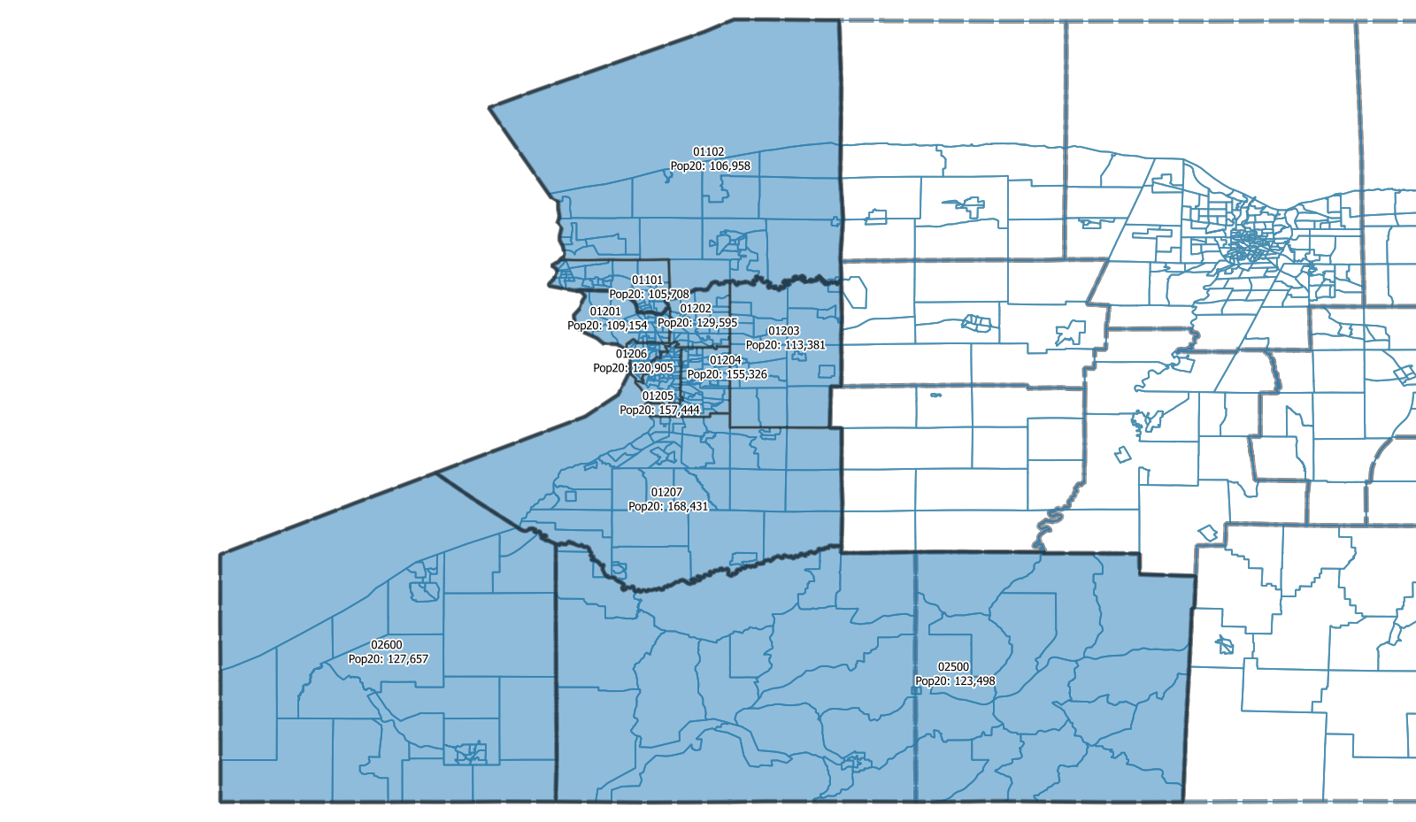
When you click on the name of an economic region on the left you will be presented with one or maps with different PUMA configurations. The first map is a map of the starting point: the PUMA boundaries as they were during the last decade. Most browsers let you open the image of the map in a separate tab or window (either right click or press and hold) which allows for looking at the map in greater detail.
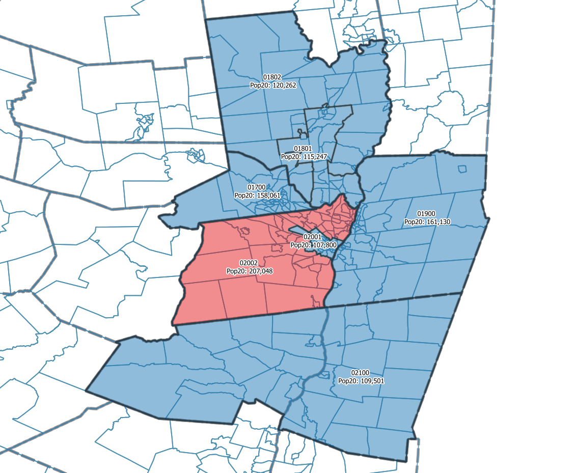
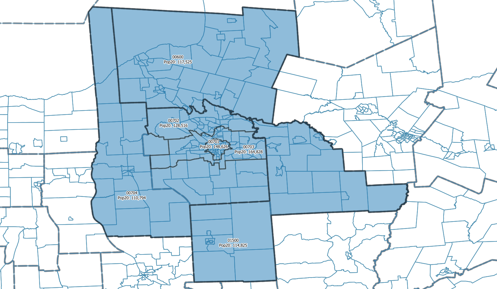
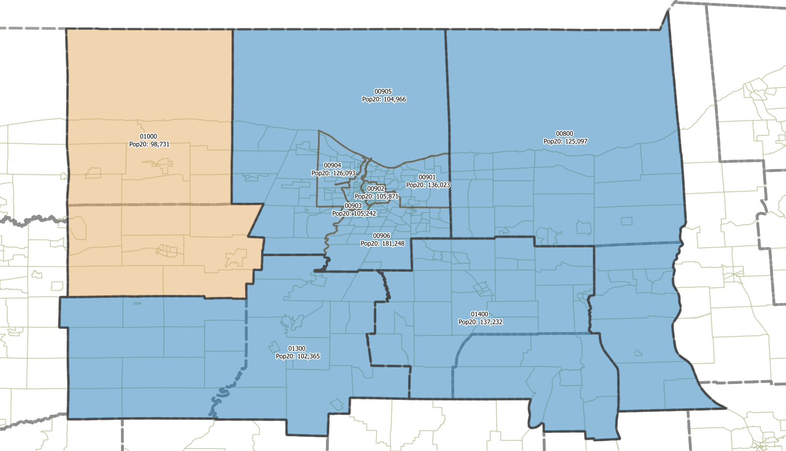
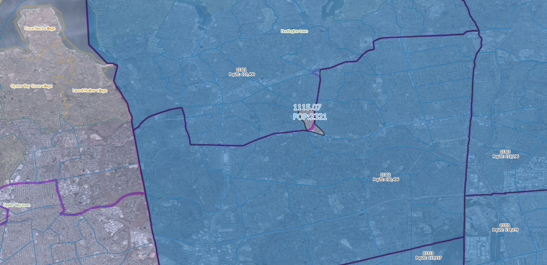
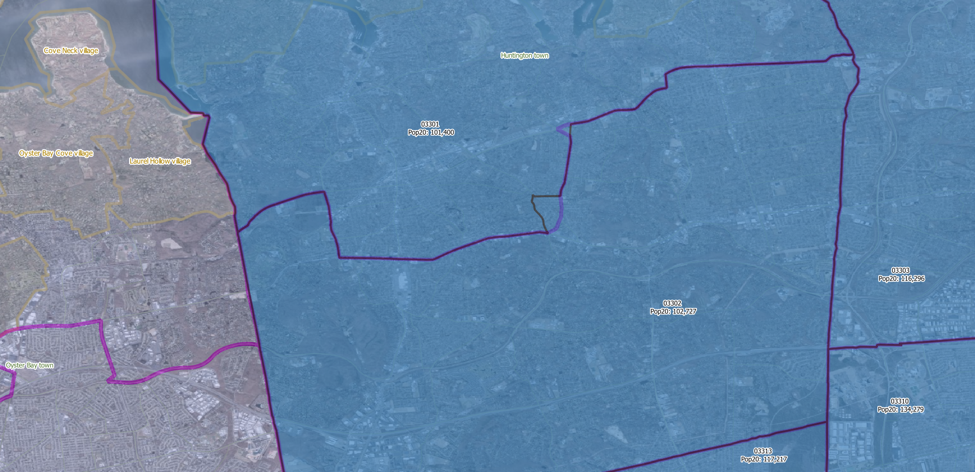
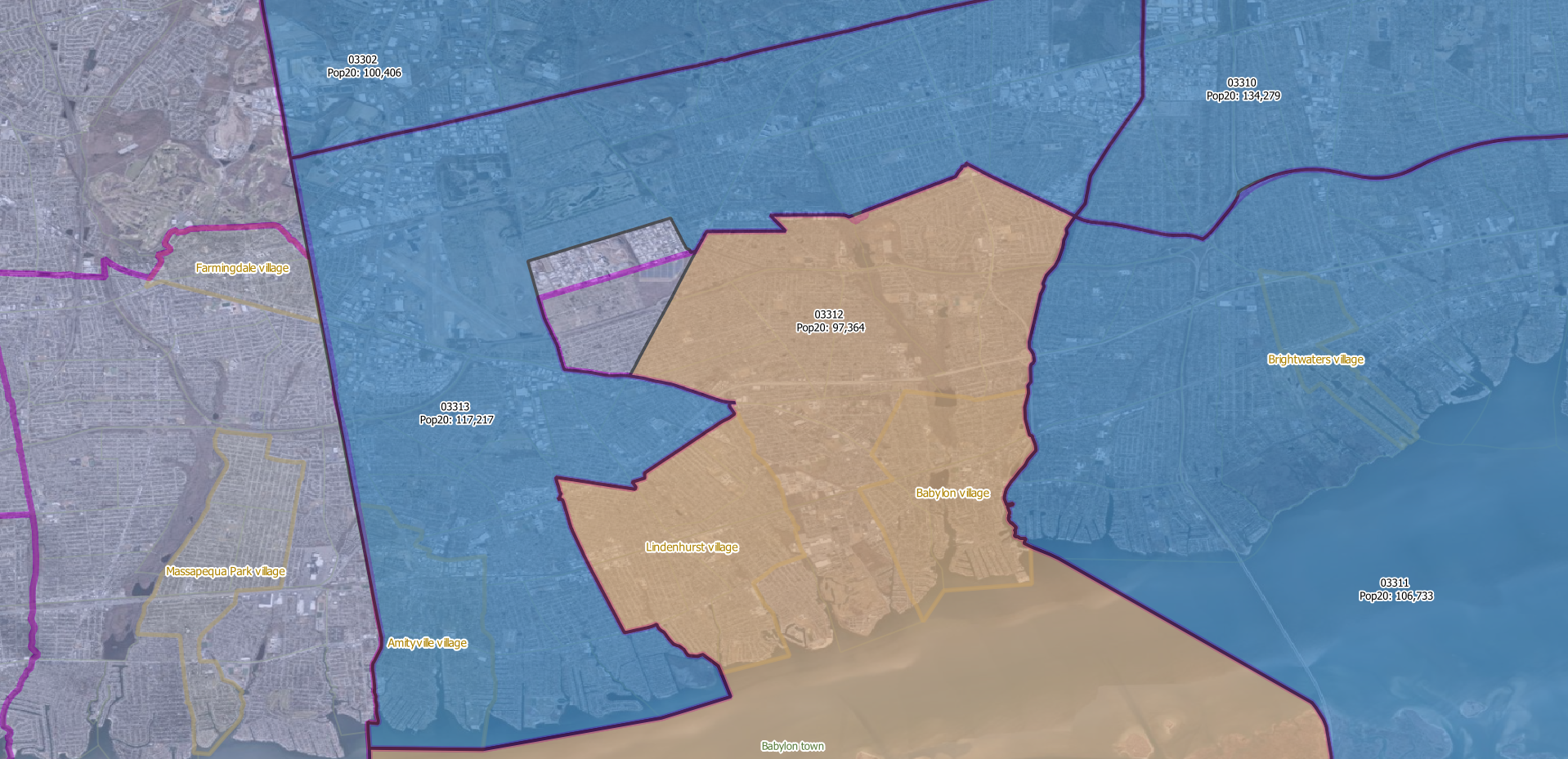
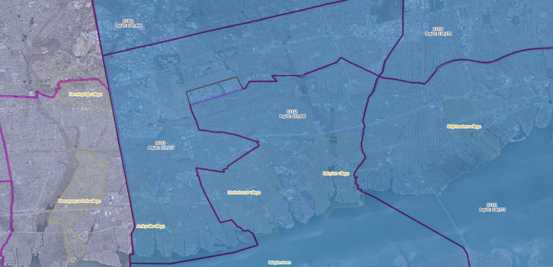
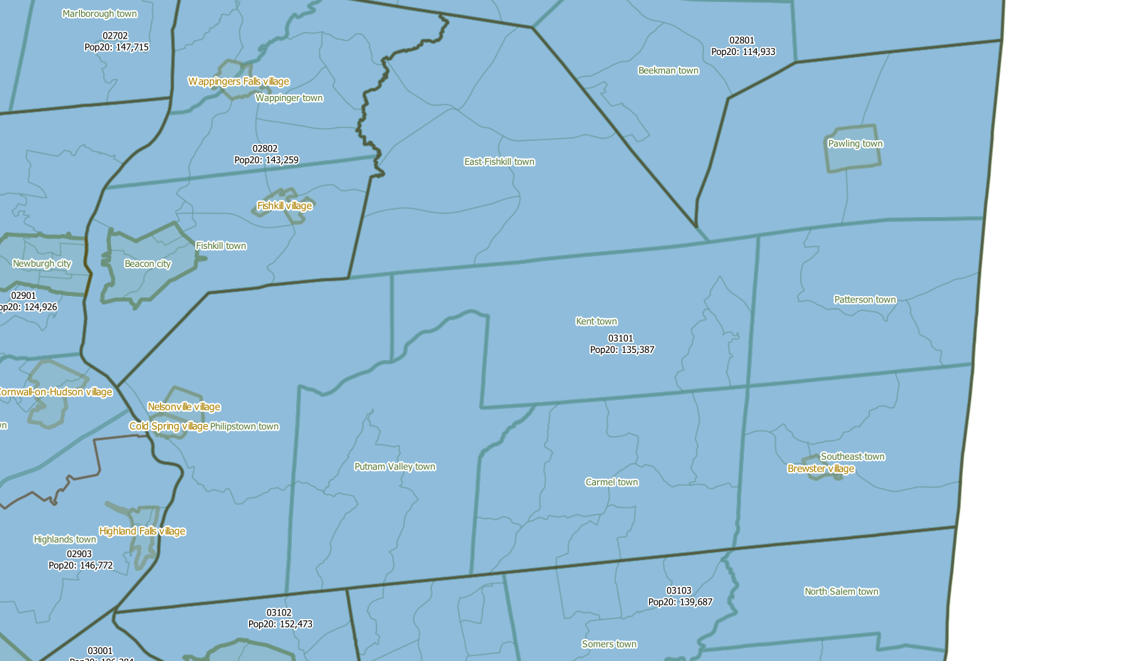
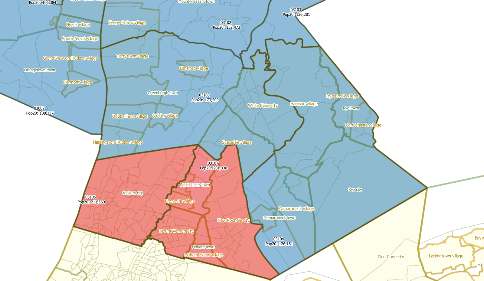
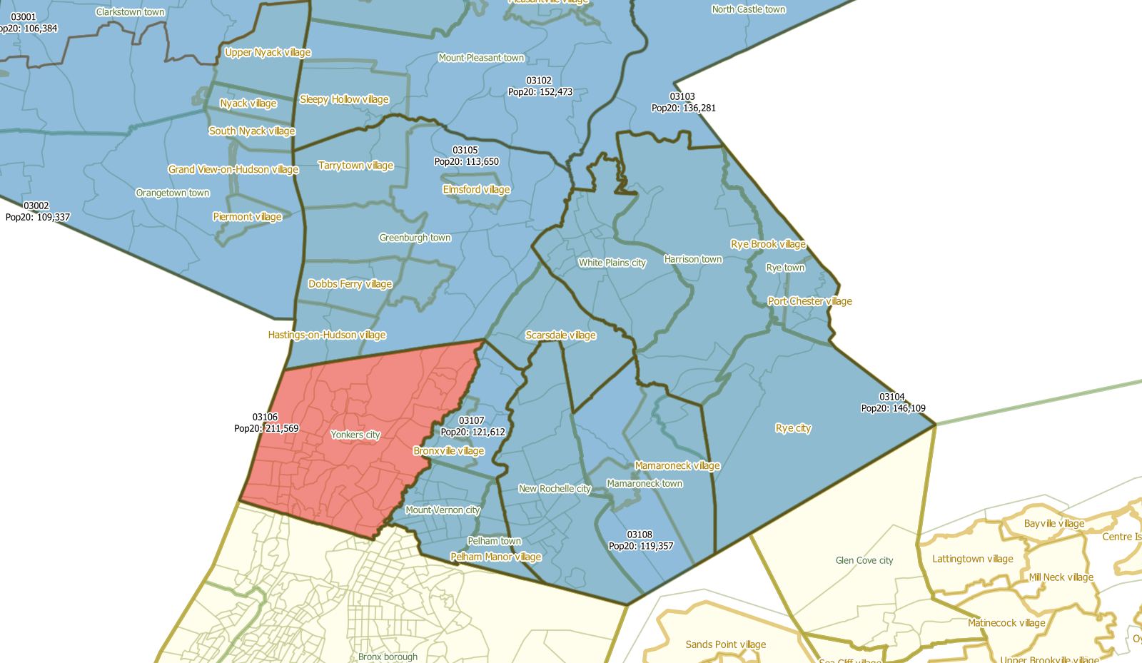
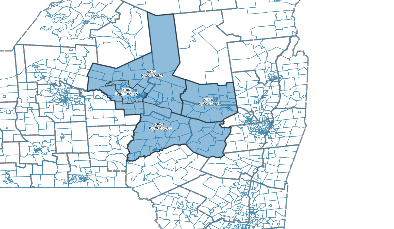
Each PUMA has a color: light orange when the population is below 100,000, red when the population exceeds 200,000 and blue when the population is between 100,000 and 200,000.
The PUMA labels indicate the PUMA ID and the 2020 population within that PUMA. Please note that the PUMA ID is subject to change and will be assigned after all delineation is completed. At that point the State Data Center will also suggest new names.
Many maps also include county boundaries and town/place boundaries. It is sometimes assumed that users of this web page are familiar enough with the area that they don't need all the labels.
Below each map is a description of changes that were made to derive this configuration and a short list of pros and cons. There is also an option to download the corresponding TEF so stakeholders can use that to import in GUPS and closely examine the configuration and manipulate.
At the bottom of each region page is a call for feedback and a mention of the configuration that will be suggested to the Census Bureau. This is subject to change as all feedback received by the State Data Center will be considered.